Photoworks began as the Cross Channel Photographic Mission in collaboration with the French CRP/Centre régional de la photographie des Hauts-de-France.
Photoworks began as the Cross Channel Photographic Mission in collaboration with the French CRP/Centre régional de la photographie des Hauts-de-France. Today we talk to Marilyn Bridges, one of the nine photographers included in the Cross Channel Photographic Mission exhibition showing at Brighton Photo Biennial 2018.
PW: The images showing in the exhibition came from the commission issued by French CRP to document France before the completion of The Channel Tunnel. Can you tell us how the commission came about?
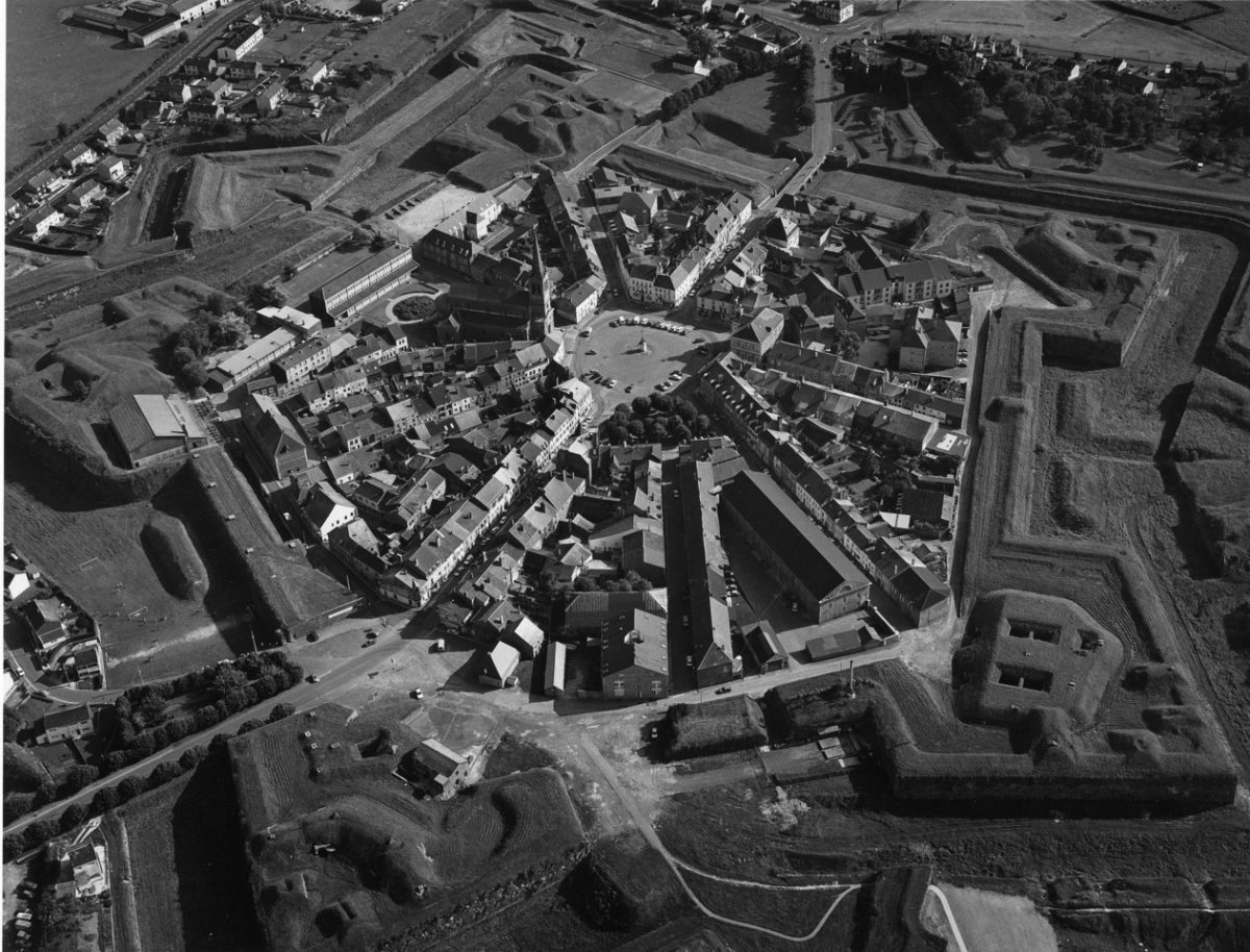
MB: I previously had some major exhibitions in France including the Arles Photo Festival. My work was all aerial and black and white. I am also a pilot, which helps in planning flights for photography. The Director of the CRP (Centre Régional de la Photographie Nord Pas-de-Calais) saw my work and thought I would be a perfect match for documenting the landscape in the North of France. The CRP commissioned me to photograph the region from the air, which resulted in a solo photo exhibition and the book Vue d’Oiseau: Mission Photographique Transmanche. The Nord contains layers of history embedded within the land. TGV tracks were then under construction along with major highways. The region was quickly changing and people would have to adapt to a new way of life. Even the ferry boats would no longer be needed. My aerial photography would document these changes to the North of France in an artistic manner.
PW: Your aerial images study the landscape through a unique viewpoint rendering the landscape abstract. With much of your work shot from this vantage point, can you tell us how you came to working in this way?
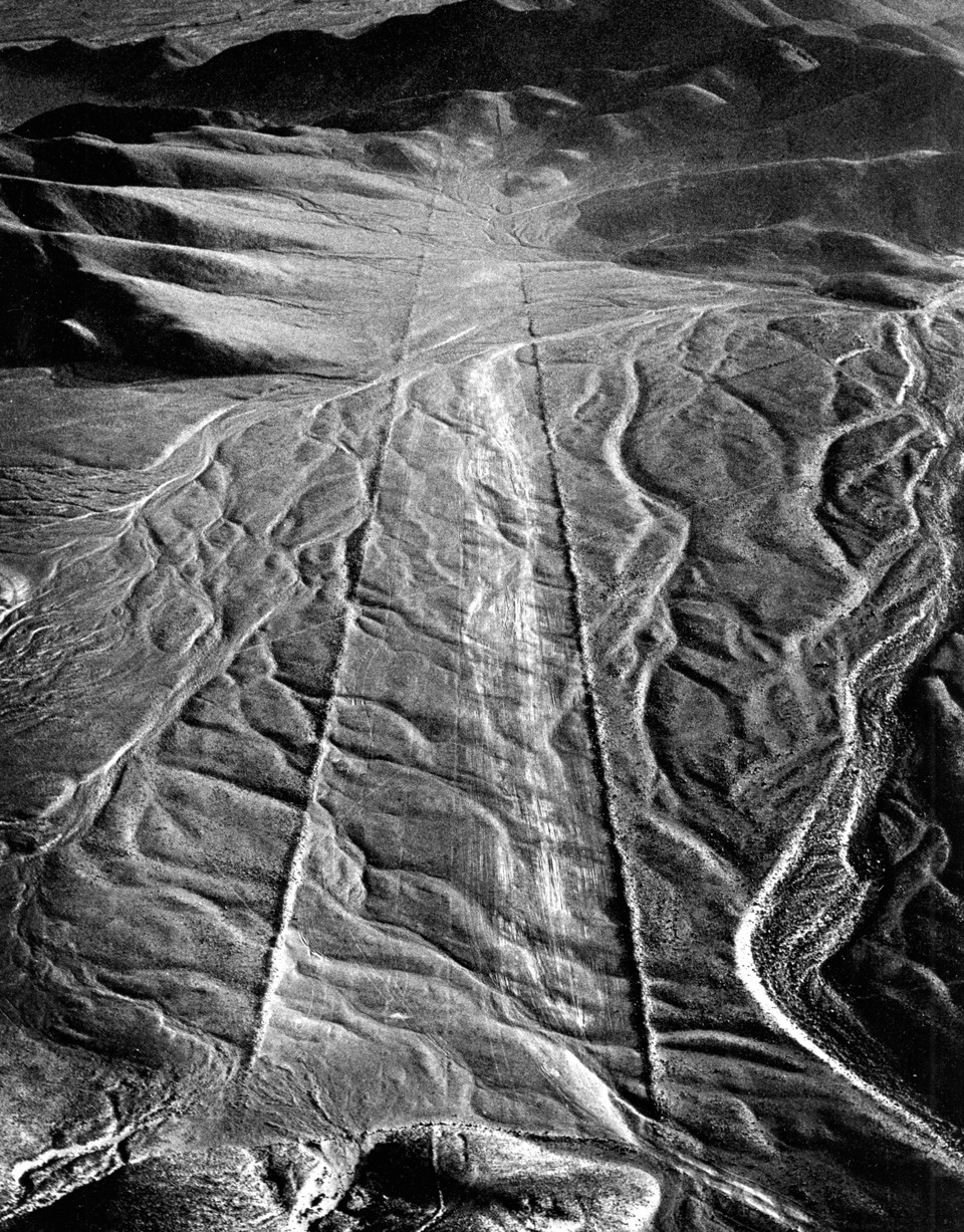
MB: As a photographer I use shapes, forms and textures to represent external recognizable reality rather than as mere abstractions of the landscape. Forty years ago, I was in Peru and wanted to photograph the Nazca lines. I found that those enormous prehistoric geoglyphs could only be seen properly from the air and that black and white worked best. So I studied aerial photography at Rochester Institute of Technology, where I earned a Master of Fine Arts degree. Later I became a pilot, so I could use the plane as a tool along with my large format film camera. That was of course before digital photography even existed. I still use the same process today, making silver gelatin prints.


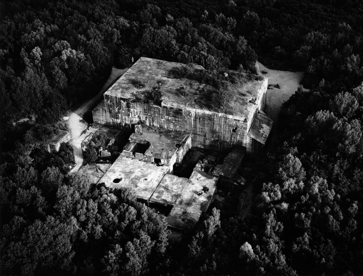
The Nazis built this massive concrete bunker in 1943 in a forest in the northern Pas-de-Calais department of France. Its purpose was to assemble, fuel and launch dozens of V-2 rockets per day against London and southern England. The bunker, built by slave labor, was the size of a football field with steel reinforced concrete walls up to 20 feet thick. Allied bombers intensively attacked the site and put it out of commission before it could be used.
PW: Viewing from above draws attention to trace and how history and time is embedded in the landscape. How aware of this are you when shooting?
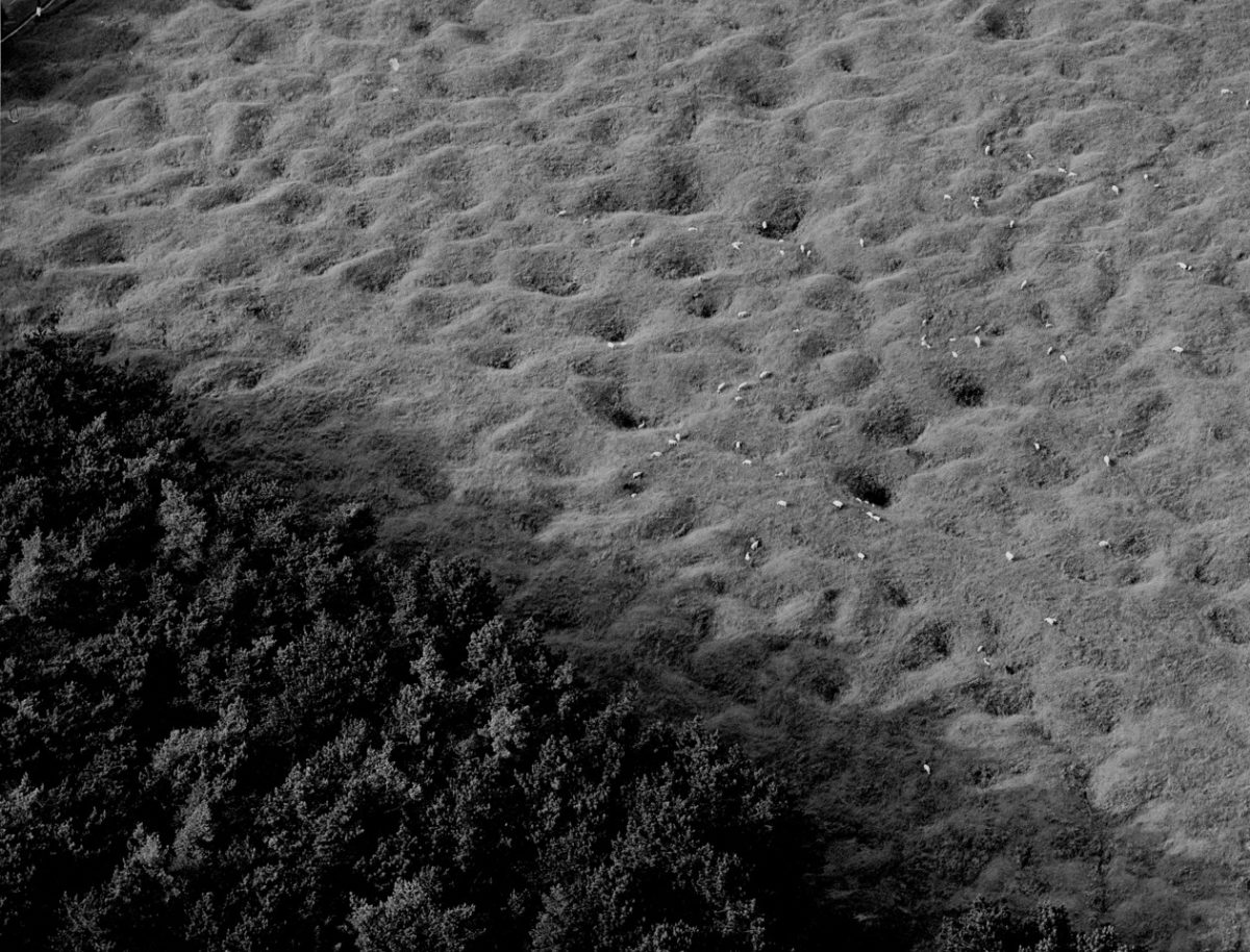
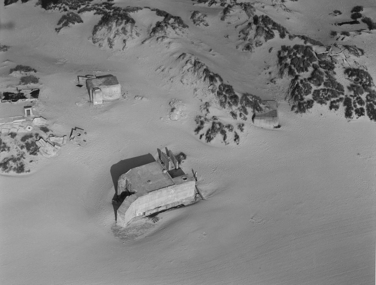
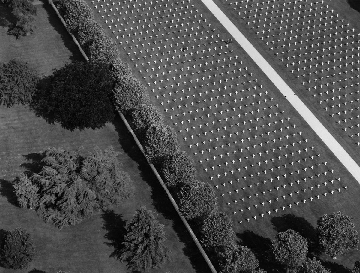
MB: I am always aware of the layers of history in my work. Much of what I photographed in the North included the remnants of two world wars. Those include military cemeteries, sheep grazing in bomb craters, people walking on the beach past ruined blockhouses, and a rocket launch pad hidden in the forest.
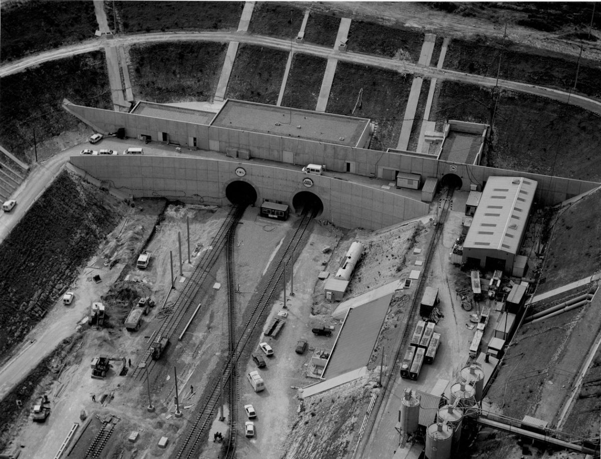
PW: Having the advantage of an overview, do you relate differently with the landscapes you shoot? What was it like seeing the progress of work on The Channel Tunnel?
MB: I was impressed by the enormous scale of the engineering works for the Tunnel and how they had already transformed the landscape.


PW: Do you look for certain landscapes when making work? Are historical sites or abandoned places more appealing than more heavily populated places?
MB: I am attracted to historical and abandoned places because they convey to me a sense of mournful poetry.


